Rock Detection and Mapping from Satellite Imagery
Project Details
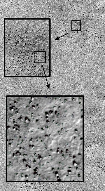
Background: This project used high resolution images taken by the HiRISE camera on board the Mars Reconnaissance Orbiter. HiRISE produces images that are 20,000 pixels across with a resolution as high as 30 cm/pixel, enabling us to see boulder-sized rocks on the surface. Such images were used to decide on a safe landing location for another Mars explorer, the Phoenix lander.
Solution: The rocks in question appear as a light spot (the rock) adjacent to a dark region (a shadow). Dependent upon the size of the shadow and given that the sun position is known, the approximate size of the rock can be calculated. Potential landing locations for Phoenix were represented by large ellipses with an area of hundreds of square kilometers. Rock distribution maps were computed over these areas to show the density of rocks, providing the Phoenix team with information about potential hazards in each region.
Alternative Applications: The rock detection technique used on this project was quite simple but enabled scaling to very large images. Many microscopic or high resolution applications deal with similarly large images and only require simple processing of image components in order to produce a large-scale summary map.